Wednesday, June 23, 2010

Road Trip Day 6: Fruita/Kokapelli Trail


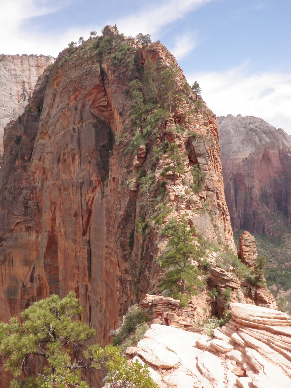
Day 6 was originally supposed to entail riding some of the Moab slickrock and canyons I raced across at the 2008 Adventure XStream Expedition Race with my adventure racing team, DART-nuun. The weather did not exactly cooperate. During our drive from Bryce Canyon towards Moab the sky went black and a raging storm chased us across the highway. We decided to bypass Moab and head straight to Fruita.


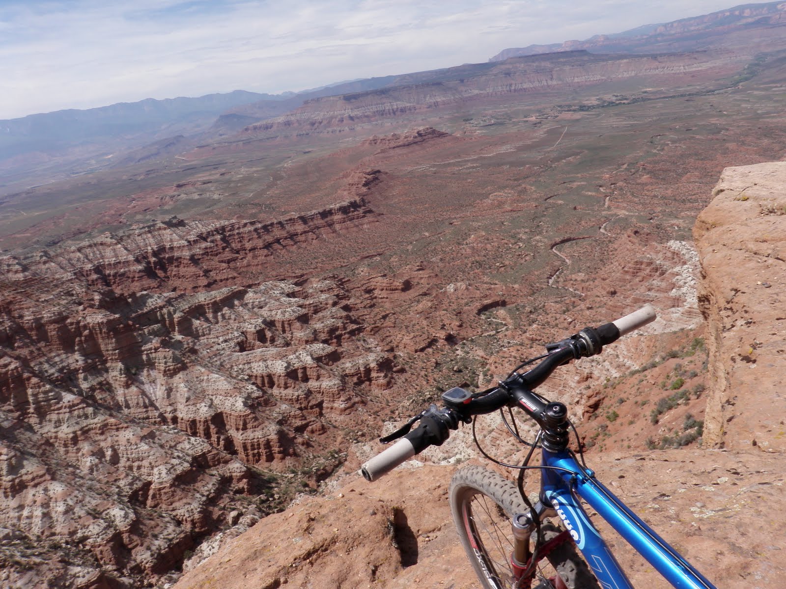
After spending the night in Fruita we woke up to rain once again. Fortunately it cleared quickly and by noon we were on the Kokopelli Trail...sort of. We inadvertently rode up Moore Fun counterclockwise, which is Less Fun than the intended clockwise route. We were able to drop down to Mary's Trail, Steve's, Kokopelli and more. Riding along the rim of the canyon cliffs with the sound of distant thunder and storm clouds rolling in around us made for an exhilarating 3 hours on the trails.


We did not make it up to the north side of town, as it started raining cats and dogs immediately after we finished this ride. Instead of waiting out the storm and hoping for dry conditions (yeah right) we decided to get the show on the road and headed east towards Vail...

Road Trip Day 5: Bryce Canyon


Bryce Canyon is one of those places that has been on my to-visit list for YEARS. Finally after a stop in Zion we were able to swoop in and run/hike through Navajo Trail and the canyons for a short but sweet visit on Day 5. With storm clouds and lightning rolling in loudly, we had a very limited amount of time to experience the HooDoos but it was certainly worth the drive.


Much like Zion, the photos do not do this place justice. You have to go there and experience this otherworldly landscape to truly soak it all in...

Road Trip Day 4: ZION National Park


Zion is trailrunning paradise.

As long as you're not afraid of heights...


And as long as you wear a Gregory pack with a 100oz Hydrapak bladder full of water and nuun. Wow, that was 3 plugs in one sentence!

After a two days of 3hr singletrack riding, we zipped over from Hurricane to nearby Zion National Park. Our plan was to run/hike up to Angel's Landing via Emerald Falls and then explore the slickrock trails of nearby Telephone Canyon. Angel's Landing is not only one of the most spectacular hikes in the world, but also one of the most exposed and deadly. There is very little margin for error, or slipping. It's over 1,000 feet straight down as you hike up a narrow ledge with chains bolted intermittently. Would I do it again? Probably not. Am I glad I was able to make it on a perfect day, snap some photos and enjoy the experience? Absolutely!

Not for the agrophobic.

Check this out:


The Road to Boulder Day 2: Gooseberry Mesa


First stop on our road trip from Huntington Beach to Boulder was St. George, Utah. We arrived late and woke up the next morning to hit the slickrock trails and magnificent desert views of Gooseberry Mesa. Recently Singletrack.com did an excellent
"Destinations" article on this area.


You never seem to go more than 10 yards in any direction at the Gooseberry. The trails are a staccato ADHD twisting labyrinth over sometimes technical stone, marked by white dots. While much smaller than the more-famous slickrock of Moab, Goose is so compact that you can't approach it as a "training ride", but instead an "experience". It almost reminded me of riding at Ray's Indoor Mountain Bike Park last year in Cleveland. While not super technical, you will have plenty of opportunities to test your skills, and/or faceplant.

Tuesday, June 1, 2010

Brainard Lake Ride


Since the weather has changed from Winter straight to Summer over the last couple weeks, I finally dusted off my waterproof camera and brought it on some of my rides and runs around Boulder. Today's ride was a climb up to Brainard Lake, which sits at 10,300 feet and is surrounded by Mt. Audubon (13200'), Paiute Peak, Mt. Toll, the Isabelle Glacier...Stunning views!

The climbing starts after a 6 mile easy warmup from home on highway 36 to Lefthand Canyon. Most of the time when I climb up to Brainard Lake I follow the "standard" route past Ward, but today I decided to continue up to Jamestown at follow Jamestown Canyon to the Peak to Peak Highway. For some reason I had never ridden higher than 8000 on Jamestown Canyon, which is too bad because that's where the real fun starts! The grade often exceeds 12%, and after climbing for an hour in the thin air it gets a bit harder to keep the heart rate down. 36 to Peak to Peak is approximately 15 miles of climbing, gaining around 4,000 feet of elevation total. This route is a bit longer, with some rolling dirt roads at the top offering great views of the Indian Peaks not too far off in the distance. Much more fun than the sometimes-crowded Ward route.


Looks like a fun 3000' climb up to Mt. Audubon's Peak...

Brainard is only about 24 miles from my house...It was 80 in Boulder and maybe 40 at Brainard. Refreshing! In the upcoming weeks when the temperature gets into the 90s in Boulder it will be a nice relief to spend more time up high. I am particularly looking forward to some nice long runs at 10,000' around the Brainard Lake area. With the Breckenridge 100 mountain bike race coming up, I need to train as much as possible between 10 and 12,000 feet to get a better feel for how my body performs at altitude an recovers from the work.


Some snapshots taken with frozen fingers:


Not a good place to swim...


WHOOSH Down the mountain!

Standing at Brainard Lake, looking around, I could only imagine the high alpine adventure this summer will hold in the Rocky Mountains..